For the interferometric analysis during the period 1993-2010, the entire available archive of ERS-1/2 and ENVISAT data for the area of interest from both descending and ascending orbits was used.
Descending orbit (period 1993-2010)
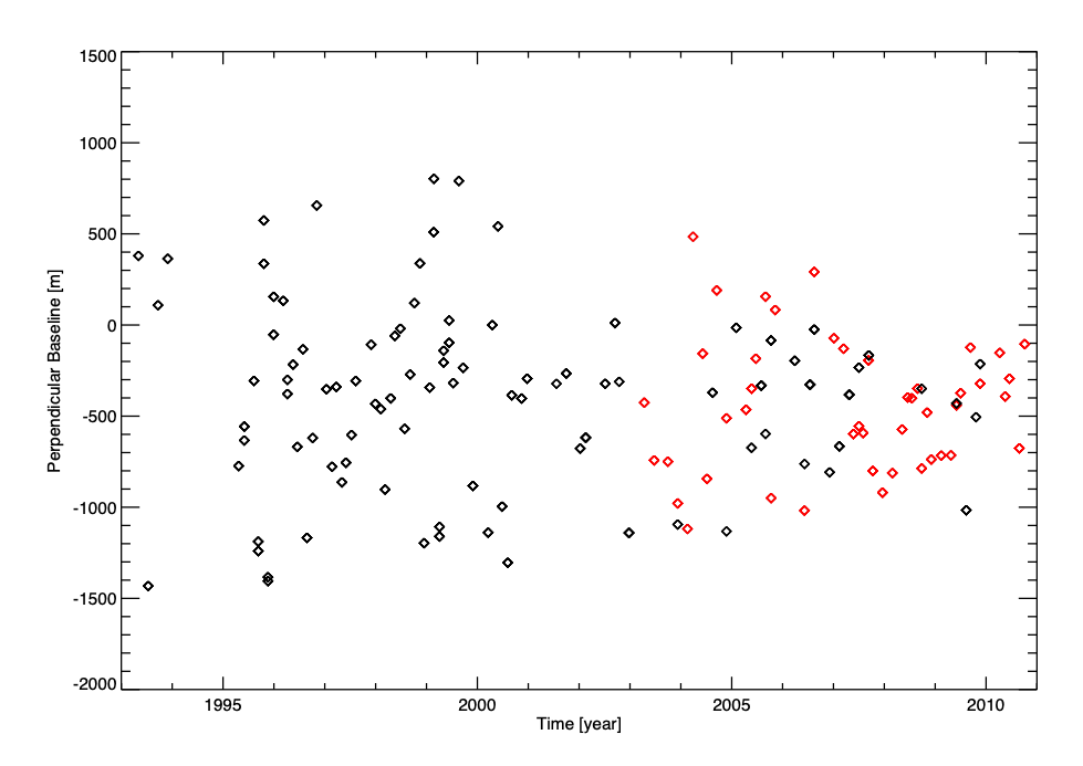
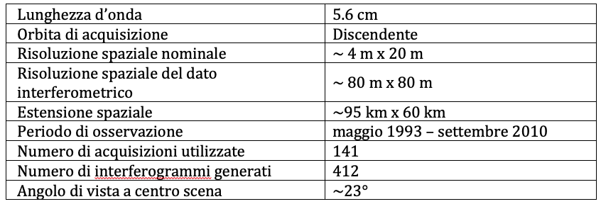
For the interferometric analysis performed with data acquired by satellite from a descending orbit (track 208), 141 satellite images were used for the period May 1993 - September 2010; Figure 1 shows the distribution of these data in the perpendicular time/baseline plane (orbital separation). In particular, the black and red rhombuses represent the ERS-1/2 and ENVISAT data, respectively. Table 1 shows the main characteristics of the dataset used.
Ascending orbit (period 1995-2010)
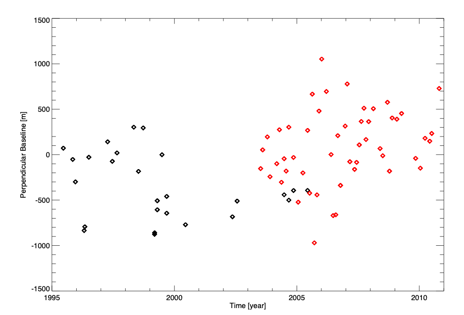
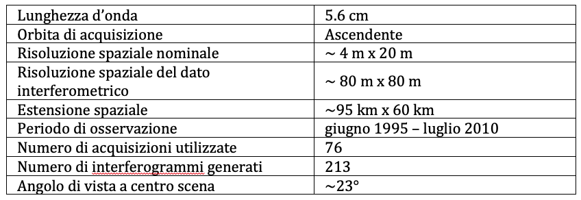
For the interferometric analysis performed with data acquired by satellite from an ascending orbit, 76 satellite images (26 ERS-1/2 and 50 ENVISAT) were used for the period June 1995 - October 2010, whose distribution in the perpendicular time/baseline plan is shown in Figure 2, where the black and red rhombuses represent the ERS-1/2 and ENVISAT data, respectively. Table 2 shows the main characteristics of the dataset used.